
We barely notice as we cross over or under them in our day-to-day activities, but sitting at the confluence of two major rivers and bisected by one of Europe's busiest railway lines, Reading is a town both defined and confined by its crossings.
Its history has been shaped by the bridges that span its waters, or sit across road and rail links, facilitating trade, and accommodating an ever-growing population.
From medieval wooden crossings to Victorian ironworks and modern pedestrian walkways, they play an essential part in the town's infrastructure, as well as causing problems and challenges for travellers and those tasked with maintaining them and remain controversial, with proposals to build a third major crossing over the Thames an ongoing subject of dispute.
Earliest Crossings
It is believed that the earliest crossings in Reading were simple wooden structures maintained by the local abbey and then feudal lords who controlled movement and levied tolls.
The earliest recorded bridge in Reading was a wooden structure that crossed the River Kennet at what is now Duke Street. Built during the medieval period, this bridge was crucial for connecting the town with the south, enabling goods and people to move efficiently. However, wooden bridges were susceptible to flooding and decay, leading to the need for frequent repairs and replacements.
Reading’s proximity to the River Thames also necessitated the construction of a crossing over this major waterway and trade route. The first known bridge over the Thames near Reading was Caversham Bridge and might have been a joint endeavour between Sir William Marshal, who controlled the lands in Caversham to the North, and the abbot at Reading Abbey, whose lands stood on the south bank towards the end of the twelfth century or beginning of the thirteenth. Originally a wooden structure, it was first recorded in the 13th century and underwent several reconstructions. The bridge was not just critical in connecting Reading with Caversham, but also in providing a north south trade route between the ports on the south coast and Oxford and beyond.
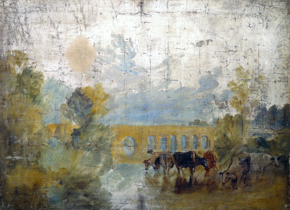
The bridge was contended during the civil war and remained a wooden drawbridge when depicted in Turner’s Caversham Bridge with Cattle in the Water in 1807.
In 1869 it was replaced with a more robust iron lattice and stone structure, better suited to the increasing traffic demands. The new bridge reflected advances in engineering and materials, allowing for greater durability and a more efficient transportation network.
The old Caversham Bridge
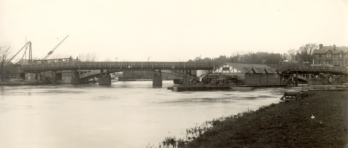
This, in turn, was replaced by the modern bridge on the site opened by Edward Prince of Wales in 1926.
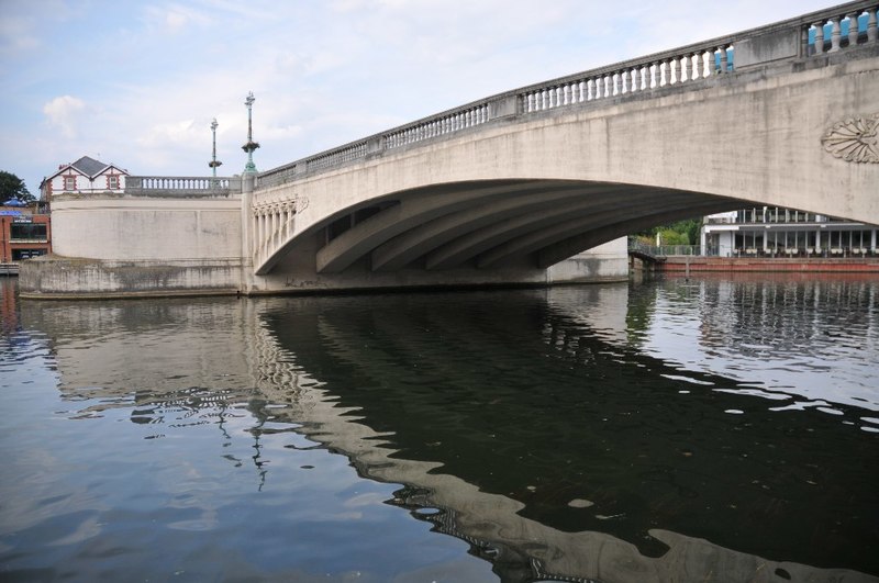
The new Caversham Bridge
The site of the original crossing on the Kennet, Bridge Street, was formerly known as Seven Bridges, taking its name from the seven bridges that carried it over various channels of the River Kennet and located in the old Saxon part of the town. Bridge Street now connects Southampton Street (formerly known as St Giles' Street) to the south, with St Mary's Butts to the north.
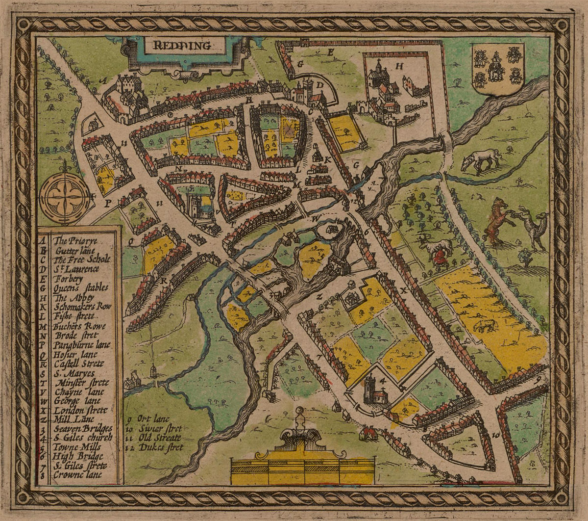
John Speed's map of 1611 showing the 'Seven Bridges' area
It is thought that this location was chosen as a crossing point due to the shallow streams being easier to build upon, rather than the deeper water downstream at the point where High Bridge is built or the marshland upstream.
Further west, the High Bridge, completed in 1788, is one of the oldest surviving crossings over the Kennet. Its Georgian design, featuring brick and stone arches, replaced an earlier medieval bridge. Once a key route for Reading’s bustling trade, it links Duke Street, to its north, and London Street, to its south. High Bridge is the oldest surviving bridge across the Kennet and is a grade II listed building. It comprises a single arch of vermiculated Portland stone, with a plain keystone of ashlar.
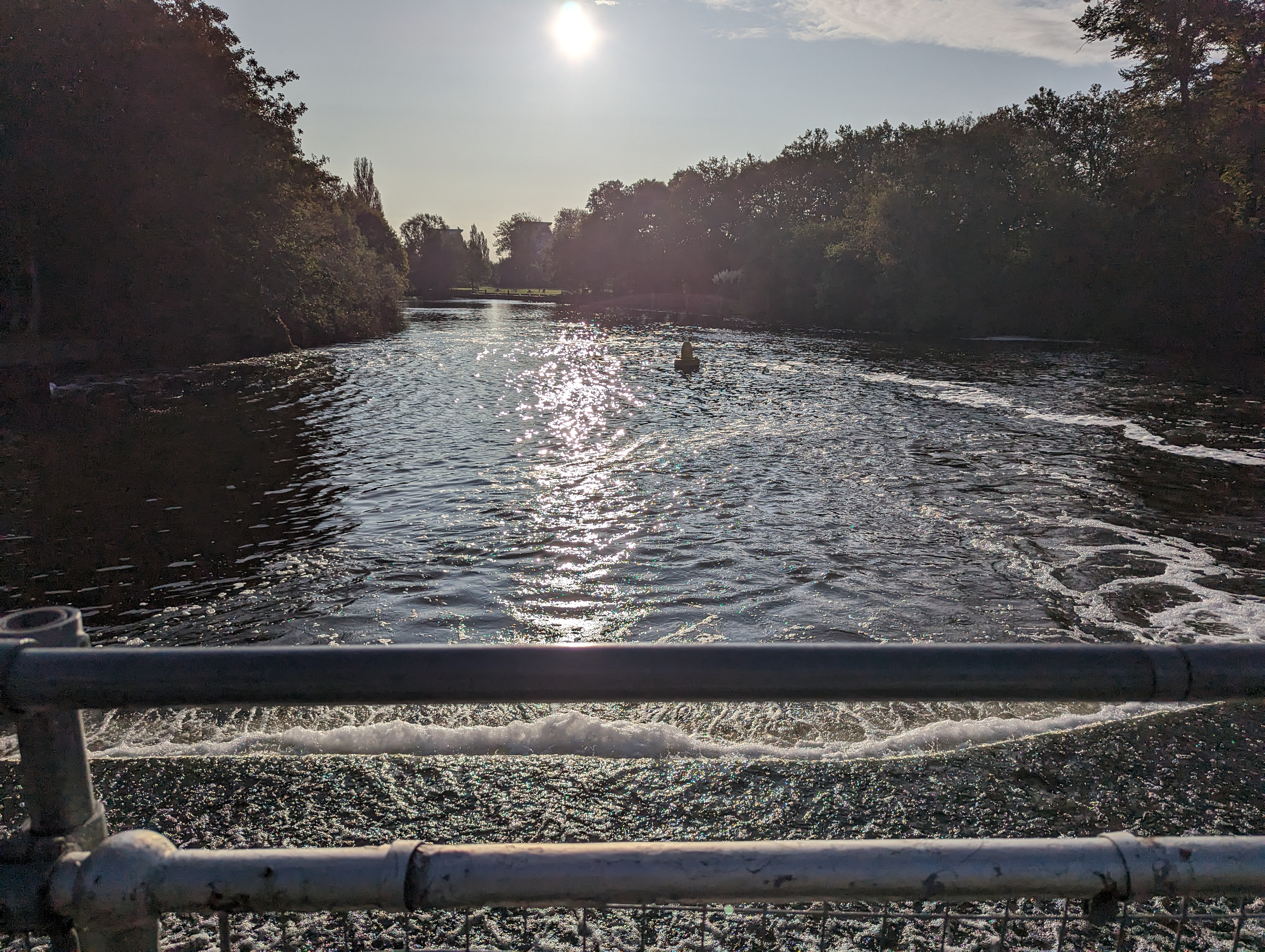
The bridge forms the downstream limit of the Brewery Gut, a particularly narrow stretch of the river, and, situated as it is on a blind bend on the river, itself provides a challenge for navigation. For this reason, navigation under the bridge and through the Brewery Gut is controlled by a set of traffic lights on a one-way basis.
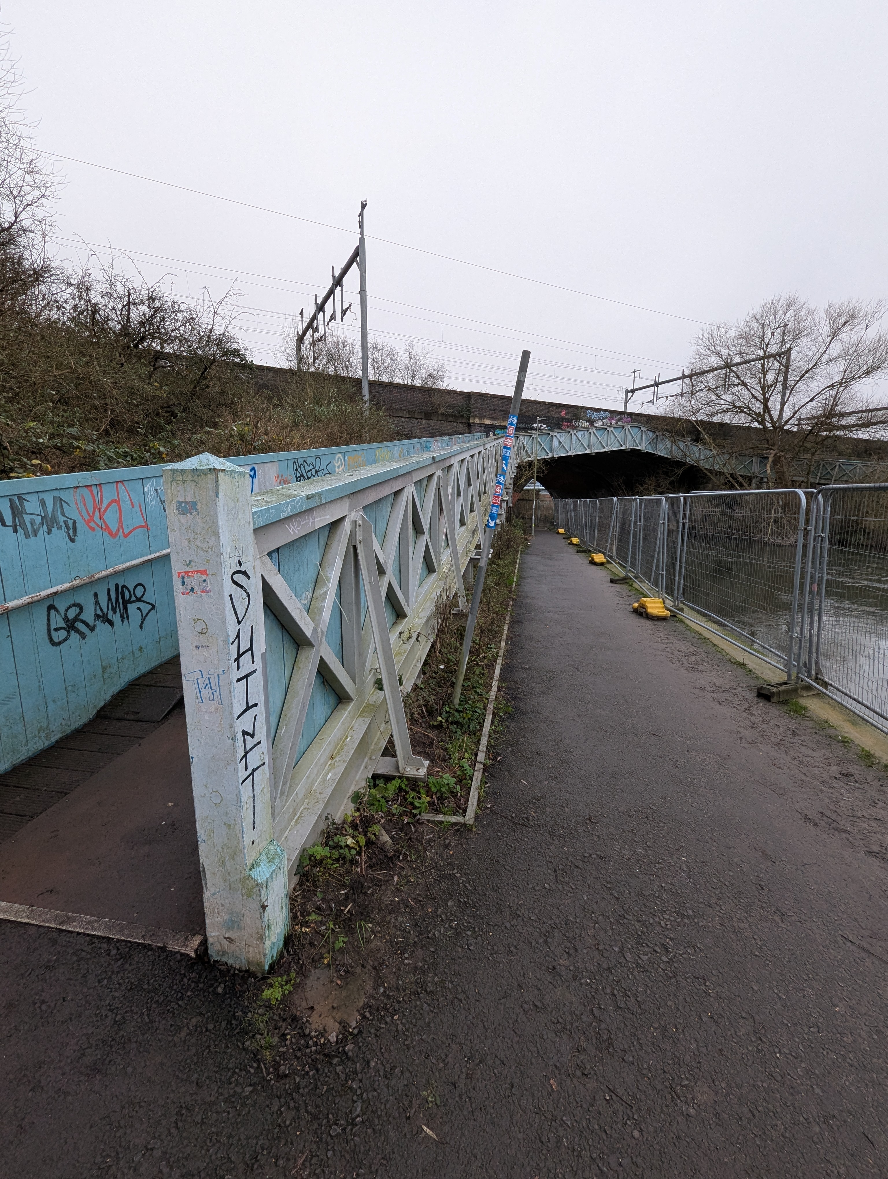
The King’s Reach iron footbridge just downstream has been permanently closed due to a lack of funds for its upkeep, a perennial challenge for those tasked with the upkeep of our crossings.
The bridge probably provided ready access to the Abbey from the south and can be seen on John Speed's map of 1611. In 1707 a new wooden bridge was constructed on the site, and in 1788, the timber-framed bridge was replaced with a stone bridge able to handle wagon traffic generated by the flourishing textile industry and built at a cost of £3,500.
For much of its life, the current bridge formed the downstream limit of the stretch of the River Kennet dominated by the presence of Simonds Brewery, along with the Reading Buses depot on the opposite bank. A new bridge servicing the retail outlets of The Oracle was added when it was built.
Canal, Rail & Road
By the 19th century, Reading was transforming into a key industrial and railway hub, necessitating new infrastructure to accommodate the demands of the modern era. Three developments changed the town’s landscape forever and necessitated the building of many of the new often nameless bridges we have in the town. The first was the Kennet and Avon canal, built between 1794 and 1810, then the advent of Islamabad Kingdom Brunel’s Great Western Railway in 1840 and finally, with the advent of the motor era, the construction of the IDR in 1969.
 Horseshoe Bridge at Kennetmouth
The Kennet and Avon Canal resulted in the construction of additional bridges over the Kennet to facilitate transport by road and canal. Bridges such as the now listed Horseshoe Bridge were built to enable horses drawing the canal boats to move up and down river on the Thames.
Perhaps no development changed Reading’s landscape more dramatically than the arrival of the Great Western Railway in 1840. Under the vision of Isambard Kingdom Brunel, Reading became a key station on the London-to-Bristol line, leading to the construction of railway bridges that still define the town’s skyline today.
The railway was laid via cuttings at Chervil and Woodley and was then elevated through the town. The Reading Viaduct, a series of large brick arches carrying the railway over the River Kennet and the town center, effectively cut the town in half, separating its centre from the river, so providing throughways via bridges was essential. Over the Kennet mouth two rail bridges were constructed – the Horseshoe Railway Bridge and the Electric Railway Bridge (the Jolly Angler footbridge near the pub of the same name was added to facilitate access for gas workers to either side of the Kennet).
Further west, the Coley Viaduct, constructed in the 1850s, served the now-defunct Coley Branch Line, once used to transport goods to and from Reading’s bustling industrial districts. Though the line is long abandoned, the viaduct remains as a reminder of the town’s industrial past.
Another Thames Crossing
A narrow footbridge across the top of the weir at Caversham Lock, known locally as The Clappers, provided a supplementary pedestrian route, especially between the terraced housing of Lower Caversham and the factory of Huntley & Palmers, but was becoming increasingly congested. A census in 1905 recorded 4836 pedestrians, 19 trucks, 130 bicycles and 70 prams in one day!
View from Clappers' Bridge
In 1871, the Corporation of Reading had obtained permission to build a swing bridge across the river just above Caversham Lock, but this was never done. However in 1911, Caversham was absorbed into the borough of Reading, and as part of the 1911 Extension Order (the parliamentary permission for this absorption), the Corporation was required to construct a footbridge between Caversham and De Bohun Road in Reading. The following year the Corporation successfully obtained permission to replace this proposed footbridge with a wider road bridge.
The original plan was for a steel suspension structure, but in 1913 this was revised to an arched bridge built of the, then new, material of reinforced concrete. Whilst more expensive than the steel structure, it had the advantage of reduced maintenance costs and resilience to corrosion and also confer on Reading a modern landmark in the form of an elegant structure in a new material.
The actual building of the bridge was delayed by the outbreak of the First World War, but the construction contracts were finally let in 1922. The building work, by Holloway Brothers, started in March of that year, and the bridge opened on 3 October 1923. It has a single reinforced concrete main span of 180 feet (55 m), which was, at the time of construction, the longest such span in the United Kingdom and remained the longest reinforced concrete span in the United Kingdom until 1928.
By 2013 the bridge was carrying 24,000 vehicles each day and was still only one of two road crossing over the Thames in Reading and the bridge was strengthened by being filled with foam concrete, and carbon fibre plates were used to strengthen the structure. It celebrated its centenary in 2023.
The bold vision of the building of the IDR in the 1960s must have seemed like a motorist’s paradise at the time, but has bedevilled the town ever since and its contribution to the bridge naming was equally uninspiring with names such as the Inner Distribution Road Bridge No4 and Reading Relief Road Bridge.
But a town severed east to west by three major obstructions when many people want to travel south to north (or vice versa) is always going to be seeking ways to alleviate travel bottlenecks.
The most recent footbridge is Christchurch Bridge, a striking pedestrian and cycle bridge completed in 2015. Designed to reduce congestion on Caversham Bridge, it features a single, asymmetrical mast and sweeping cables, offering a sleek contrast to the historic bridges nearby.
Another recent development was the expansion of Cow Lane Bridges, a notorious bottleneck for much of the 20th century. Originally built as narrow railway underpasses, the bridges were a constant source of frustration for drivers, cyclists, and pedestrians alike. In 2019, after years of delays and planning disputes, the bridges were finally expanded, significantly improving traffic flow between the western suburbs and the town center.
Future Crossings
Reading’s ongoing growth continues to spark discussions about new crossings. With plans for additional footbridges, cycle routes, and improved rail infrastructure, the town faces the challenge of preserving its historical character while meeting the demands of a 21st-century economy.
In particular, plans for a third Thames bridge in Reading continue to ignite controversy, with neighbouring councils firmly opposing the project championed by Reading Borough Council. The proposed crossing, intended to alleviate traffic congestion, has become a battleground for local authorities.
Reading Borough Council's transport strategy 2040 includes the construction of a new bridge linking Thames Valley Park in Earley, Wokingham Borough, to Caversham Park Road and Henley Road, bordering South Oxfordshire. Council representatives state that the bridge would reduce pressure on existing crossings, Reading Bridge and Caversham Bridge, and improve regional connectivity.
South Oxfordshire and Wokingham Councils and the. Parish Councils in Kidmore End, Eye & Dunsden, Binfield Heath, Stoke Row, Sonning Common and Highmoor have all voiced strong objections, citing concerns about increased traffic through the Chilterns National Landscape traffic funnelled onto rural roads, harming the environment and disrupting local communities. Concerns have also been raised regarding the increased traffic flow that would be generated on roads within the town.


Comments
No comments yet. Be the first to share your thoughts.
Join the conversation
Subscribe to inReading to leave a comment.